Florida has more coastline than any state this side of Alaska.
It also has more established trail milage than virtually any other state. The trick is to bring it all together.
Phase one: tie down all the trails that are already out there.
Phase two: link them together.
The goal: an integrated trail network from Jax to Pcola.
One of the things that makes this "doable" is that both Florida coasts are generally protected by barrier islands. You stay inside the islands....you stay out of big water.
For Simplicities sake, we will use the DEP Greenways & Trails Regions. We've also borrowed their maps.
(I hope they don't mind).
As a South Florida Bush Paddler.....I will start with the home region.
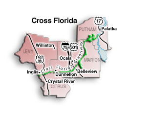
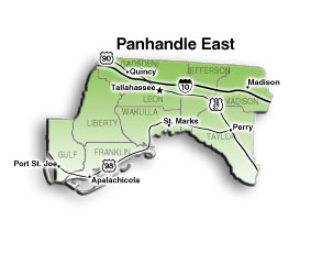
Unlike its name suggests....the Cross Florida region does not go all the way across the state. However, it is home of the Cross Florida Greenway (but that's a dirt trail). It is also home to Crystal River and its Manatees as well as the southern end of the Big Bend Saltwater Paddling Trail. At 105 miles the Big Bend Trail is one of the state's longest and newest paddling trails.
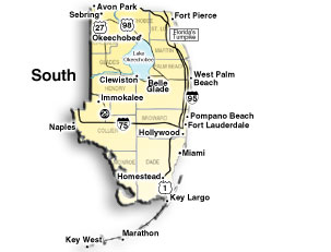
The South Region stretches from Fort Pierce on the North East to Key West on the South & Back up to Naples on the North West.
It contains the most populated and most wild parts of the state. It also contains two of the state's greatest paddling trails. The oldest....The Wilderness Waterway and the newest...The Florida Keys Paddling Trail!
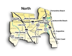
See....this one does cross the entire state. This region is home to the north eastern end of the circumnavigation On the east) and the middle of the Big Bend Trail (on the west). It is home to the St. Johns River (one of the few rivers in the world that flows north.....why?.....because Georgia sucks!). On the East Coast you can either go along the coast through the Northeast Florida Blueway or down the St. Johns River which is an American Heritage River. On the West side just stay on the Big Bend